From: Whales in the Classroom – Oceanography
By Lawrence Wade
Graphics by Stephen Bolles
Before starting this lesson, I recommend that you do the previous lesson on the Features of the Sea Floor. To do that lesson go to: http://oldnaturalist.com/?p=11077
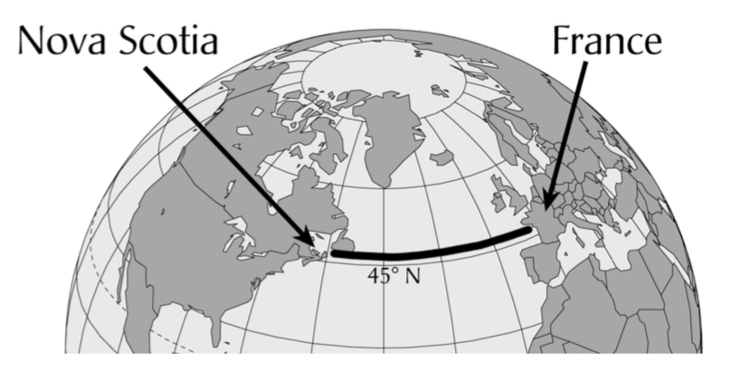
We can’t start mapping the seafloor across the Atlantic Ocean from Nova Scotia to France, until we know something about how sound travels in water.

key: 1. five times faster 2. approx. 4 seconds for the echo to be received


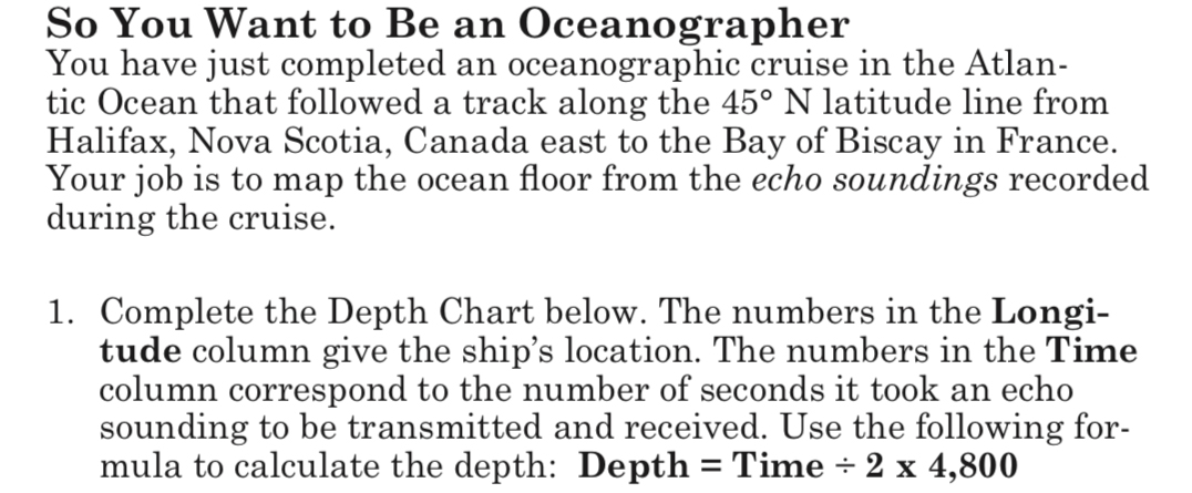
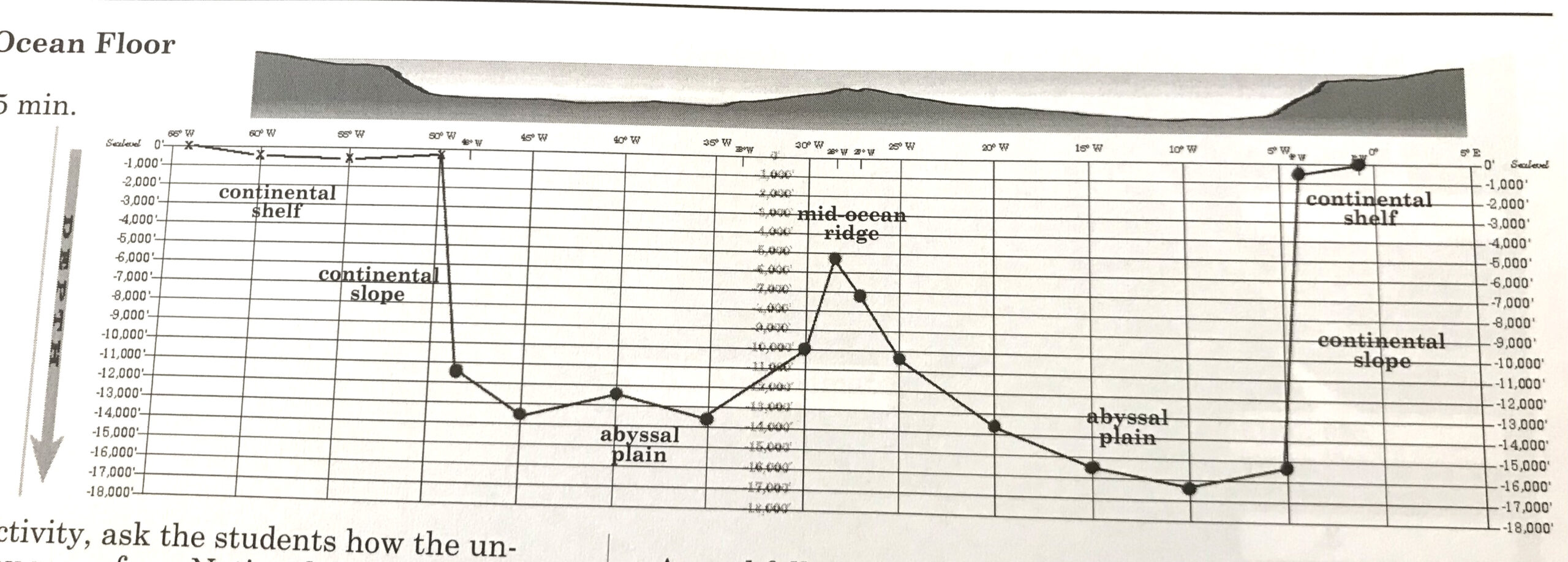
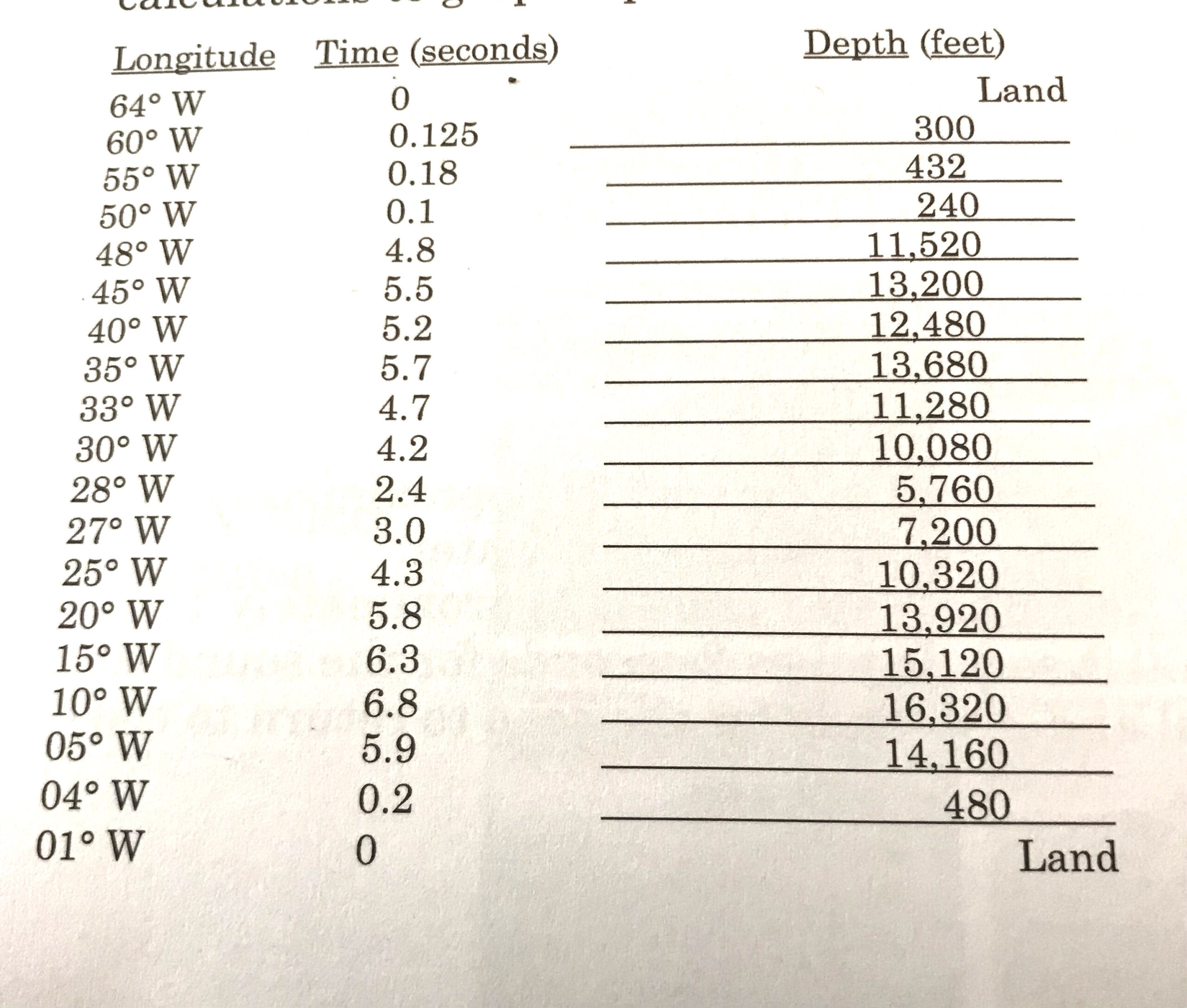
Download Ocean Floor Depth Chart which is shown below
Depth Chart
2. Double check the depths that you calculated using the key at the end of the post.
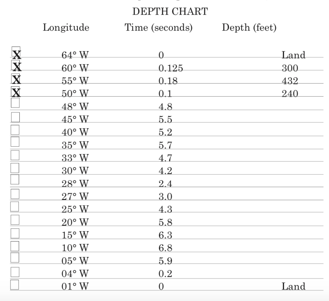
3. Download both pages of the ocean floor graph shown in miniature below:
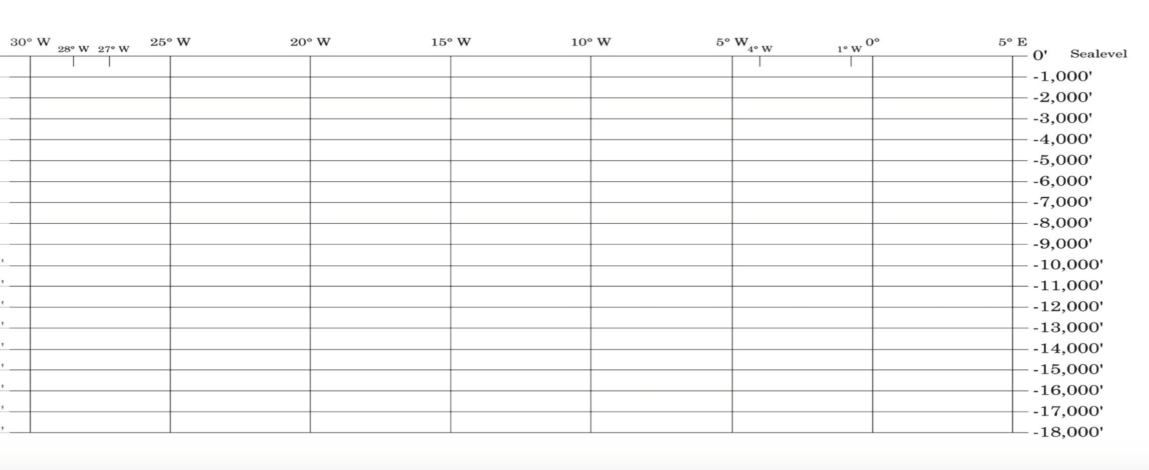
Download page 1 and 2 of the Ocean Floor Graph which is shown above
Depth Graph page 1
3. Once all of the depths are calculated, plot the depths on the graph on the next two pages. The depths at 60°W, 55°W, and 50°W are already plotted on the graph.
Let’s plot the depth at 48°W together.
According to our depth chart the depth at 11,520 feet. Place a ruler across the graph at that depth. Find 48°W and make an imaginary vertical line to the ruler. Plot the point where the vertical line and ruler meet. Plot all of the remaining depths in this fashion.
4. Connect all of the points. The line that develops is a profile of the ocean floor from Nova Scotia to France.
5. Look at the graph and label the following topographic features of the ocean floor:
a. Continental Shelf
b. Continental Slope
c. Abyssal Plain
d. Ocean Ridge
6. In the space above the graph make a three dimensional sketch of the actual sea floor.
Key for the Activity:
Depth chart:
Ocean Floor Graph